Since the publication of the
Bloody Bay Wall Project, researchers have expressed interest in the image, making the point that in an image having the accuracy and resolution of the Bloody Bay Wall images, the sample area may be large enough to determine the biodiversity of a region. At the very least they could be an important snapshot of the coral reef and marine life. It is no surprise that when analyzing the first series of "landscape" images produced in the Caribbean, distinct similarities stand out because the images are captured in the same region and the biodiversity is essntially the same.
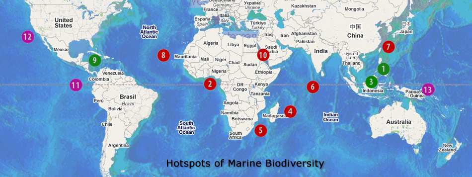
Published in 2002, a study by the Center for Applied Biodiversity Science (CABS) at Conservation International identifies the world's top 10 coral reef hotspots for biodiversity and threat of extinction. Because of the rich variety of marine species concentrated in such small areas, these regions are most susceptible to the extinction of marine species due to the destruction or degradation of coral reefs from global warming and human activities.
With these concepts in mind, a grand plan emerged to image coral reefs in all of the world's marine biodiversity hotspots, both as a kind of record of what these regions are like now, and also as a means to create awareness of why we need to protect the world's oceans. The first stage of the project, completed in 2008 completed new images in the Caribbean, Philippines and Malaysia. The remaining seven regions, shown on the map in red are planned in the future along with additional regions that, while not on the hotspot list, are environmentally important.
Contents copyright ©2009 Jim Hellemn all rights reserved permission required for use of any content or images


